Mount Ciremai Linggarjati Route Continues to Challenge Mountaineers with Historical Significance and Extreme Terrain
On July 6, 2023, a group of mountaineers successfully reached the summit of Mount Ciremai via the Linggarjati route, reaffirming the trail’s status as the most demanding path to the highest point in West Java. Known for its unforgiving verticality and historical weight, the Linggarjati route remains a legendary passage for outdoor enthusiasts and history buffs alike. Located in the Cilimus District of Kuningan Regency, the trail starts near the historic Linggarjati Agreement Building, a site of immense significance in Indonesia’s struggle for independence. This recent expedition, which included minors as young as nine and thirteen, highlights the enduring appeal and the rigorous physical demands of the "Roof of West Java."
The Legendary Status of the Linggarjati Trail
Mount Ciremai stands as an active stratovolcano reaching an elevation of 3,078 meters above sea level (masl). Among the five official trekking routes—Apuy, Palutungan, Linggarjati, Linggasana, and Trisakti Sadarehe—the Linggarjati path is widely recognized by the Gunung Ciremai National Park (TNGC) office and the hiking community as the most grueling. Unlike other routes that offer occasional flat sections or "bonuses," Linggarjati is characterized by a relentless incline from the starting point to the crater rim.

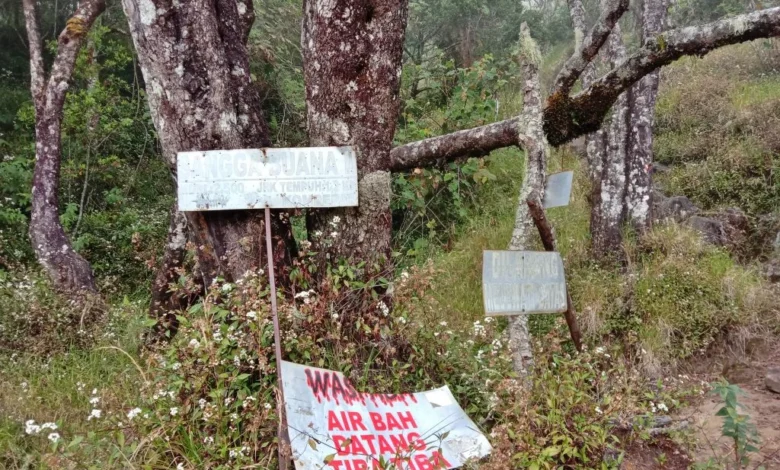
The trail’s reputation is built on its steep gradient and the complete absence of water sources along the path. Hikers are required to carry their entire water supply from the Cibunar base camp, which serves as the primary registration and starting point. Since early 2023, the registration post was officially moved to Cibunar to streamline the ascent process and improve monitoring of hikers entering the national park.
A Chronological Journey Through Folklore and History
The ascent via Linggarjati is not merely a physical feat; it is a journey through layers of local folklore and colonial history. Each "Pos" (checkpoint) along the route carries a name that reflects the cultural heritage of the Kuningan region.
The Haunting Legacy of Pos 4: Kuburan Kuda
At Pos 4, known as Kuburan Kuda (The Horse Grave), the trail passes a site rumored to be the resting place of horses belonging to Japanese officers during the occupation era. Historical accounts suggest these horses were used by overseers monitoring forced labor (romusha) in the coffee plantations that once blanketed the mountain’s lower slopes. Local residents and veteran hikers often speak of the "wingit" (eerie) atmosphere of this section, advising travelers to maintain decorum and avoid passing through late at night.

The Physical Toll of Pos 8: Bapa Tere
Further up, the terrain shifts into an aggressive display of natural obstacles at Pos 8, named Bapa Tere (The Stepfather). This section is infamous for its "root ladders"—massive, protruding tree roots that hikers must navigate like a vertical maze. The name itself stems from a grim local legend about a stepfather who committed a crime against his child at this location. Geologically, this area represents the transition into the higher montane forest, where the path narrows and requires hikers to squeeze through tight passages between ancient trees.
The Mystery of the Disappearing Batu Lingga
Pos 9, Batu Lingga, holds deep spiritual significance. Historically, it is believed to be the site where Sunan Gunung Jati, one of the Walisongo (Nine Saints of Islam in Java), performed prayers and sought divine guidance during the resistance against Portuguese colonial forces. In the early 2000s, hikers reported the presence of a massive stone—the size of an elephant—at this site, often surrounded by offerings. However, reports from park rangers, including the well-known Ranger Kang Ewer, confirm that the massive stone mysteriously disappeared or shifted from public view over two decades ago, adding to the mystical aura of the Linggarjati route.
The Psychological Threshold: Pos 11 Pangasinan
Reaching Pos 11, Pangasinan, at 2,813 masl, marks a critical psychological and physical junction. The name "Pangasinan" carries two primary historical interpretations. One refers to it as a site of exile where Indonesian republicans were left by Japanese forces; another suggests it originates from the "nasi dan garam" (rice and salt) carried by the saints during their spiritual retreats.

At this altitude, the forest canopy begins to thin, replaced by sub-alpine shrubbery and the iconic Javanese Edelweiss (Anaphalis javanica). The thin air and the exposed terrain make this section a "make-or-break" point for many. During the July 6 expedition, the group—consisting of lead hiker Mochamad Rona Anggie, nine-year-old Muhammad Kaldera, and thirteen-year-olds Rean Carstensz Langie and Evan Hrazeel Langie—arrived at this boundary after several grueling hours. Experts note that at this stage, the risk of acute mountain sickness (AMS) increases, requiring hikers to be hyper-aware of their respiratory limits.
The Final Scramble to the 3,078-Meter Summit
The final stretch from Pangasinan to the summit is a 500-meter climb that gains approximately 265 meters in vertical elevation. This section typically takes an hour to complete due to the 60 to 75-degree incline and the loose volcanic scree. Hikers must engage in "scrambling"—using both hands and feet to navigate the rocky terrain.
The summit of Mount Ciremai is unique due to its double crater system. The caldera has a radius of approximately 600 meters and a depth of 250 meters. While the view of the "sea of clouds" is a major draw, park authorities maintain strict safety warnings. The crater rim is narrow and unstable; several fatalities have been recorded over the years involving hikers falling into the volcanic vent. On the day of the summit, the group reached the peak at 09:25 WIB, benefiting from clear weather and minimal volcanic gas activity.

Cross-Generational Appeal and the Makassar Expedition
The July 2023 climb also highlighted the diverse demographic of Indonesians tackling the mountain. Rona Anggie’s group encountered a 10-person team from Makassar and Jakarta. This group included a 5th-grade student and a 2nd-grade junior high student, alongside six climbers in their 40s, 50s, and 60s.
One notable climber, 52-year-old Juanda, a Kuningan native residing in Makassar, shared that this was a "redemption climb." In 2022, he had been forced to abort his ascent at Pos 7 due to a medical emergency involving gallstones, which resulted in a six-day hospitalization. His return to the Linggarjati route, despite its difficulty, underscores the deep personal and spiritual connection many feel toward Ciremai. The presence of climbers in their 60s successfully navigating the steepest route serves as a testament to the physical resilience of the veteran mountaineering community in Indonesia.
Environmental and Management Implications
Mount Ciremai was designated a National Park in 2004, shifting its management from a protected forest to a conservation-focused entity. The TNGC office has implemented several modern systems to manage the influx of hikers:

- Online Booking System: To prevent overcrowding and manage the ecological footprint, all hikers must register through an online portal. This allows the park to cap daily entries and ensure that every hiker is accounted for.
- Zero Waste Policy: Rangers conduct thorough gear checks at the Cibunar base camp. Hikers are required to bring back all plastic waste, and "trash audits" are common upon descent to ensure compliance.
- Water Management: The lack of water on the Linggarjati route remains the primary safety concern. National Park officials emphasize that hikers should carry at least 3-4 liters of water per person for a two-day trek, as dehydration is a leading cause of rescue calls on this specific trail.
Analysis: The Significance of High-Altitude Petrophy
The successful ascent of minors and seniors on the Linggarjati route reflects a growing trend in Indonesian "adventure tourism" where the focus is shifting from pure athleticism to family-oriented educational expeditions. For the younger climbers, such as nine-year-old Muhammad Kaldera, these experiences are instrumental in fostering environmental stewardship and historical awareness.
From a regional perspective, the Linggarjati route is a vital economic driver for the Cilimus District. The shift of the registration post to Cibunar has helped local residents tap into the tourism economy by providing porter services, base camp logistics, and transport. However, the "mystical" and "extreme" branding of Linggarjati also serves a practical purpose: it discourages unprepared casual hikers from attempting a route that requires significant physical conditioning, thereby reducing the strain on search and rescue (SAR) resources.
As Mount Ciremai continues to be a focal point for West Javanese identity, the Linggarjati route stands as a bridge between the nation’s revolutionary past and its adventurous present. Whether it is the mystery of the disappearing Batu Lingga or the sheer physical challenge of the Bapa Tere roots, the trail ensures that every person who reaches the summit has not only conquered a mountain but has also paid homage to the history and legends of the land.