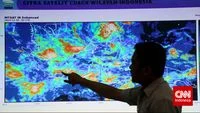
The science of meteorology often faces public scrutiny when the reality of the weather deviates from the forecast provided by official agencies. The Indonesian Agency for Meteorology, Climatology, and Geophysics (BMKG) has recently addressed these discrepancies, providing a detailed explanation as to why forecasts—despite utilizing sophisticated technology and advanced mathematical modeling—can occasionally fail to align with the actual conditions experienced on the ground. This phenomenon, while frustrating for the public, is rooted in the inherent chaotic nature of the Earth’s atmosphere and the limitations of current predictive technology.
The Science Behind the Simulation
At the core of meteorological forecasting lies the use of numerical weather prediction (NWP) models. These models are essentially complex mathematical frameworks that simulate the state of the atmosphere by processing vast quantities of data. BMKG emphasizes that these models are not crystal balls but rather calculated representations of potential future outcomes based on current observed data.
To generate a forecast, meteorologists gather a massive array of atmospheric variables. This includes temperature data from thermometers, atmospheric pressure from barometers, humidity levels from hygrometers, wind speed and direction from anemometers, and precipitation measurements from pluviometers. These ground-based observations are supplemented by high-altitude data from weather balloons, as well as expansive observational networks from satellites and ground-based weather radars.
However, the "initial condition"—the starting point of these models—is where the primary challenge resides. If the initial data contains even a slight margin of error, the final output of the simulation can diverge significantly. This is a classic manifestation of the "Butterfly Effect" in chaos theory, where small changes in initial conditions can lead to vastly different outcomes in complex systems.
The Butterfly Effect and Atmospheric Chaos
To illustrate this complexity, the BMKG offers a compelling analogy: the trajectory of two soccer balls kicked from the same position. If the two balls are kicked at even a slightly different angle, they may start close together, but as they travel further, the distance between them grows exponentially. By the time they reach their destination, they could be on opposite sides of the field.
The atmosphere behaves in a similar, non-linear fashion. A minor change in moisture content or a slight shift in wind shear that was not captured by the initial sensors can cascade into a completely different weather pattern within a few hours. Because the atmosphere is a fluid system in constant motion, it is susceptible to these unpredictable fluctuations, making absolute accuracy an elusive goal for even the most advanced supercomputers.
The Scale of Prediction: Why Local Forecasts Are Challenging
Another frequent point of confusion for the public is the discrepancy between city-wide forecasts and hyper-local conditions. Meteorological agencies often produce forecasts for broad administrative areas, such as a city or a regency. These forecasts are intended to represent the "most significant" weather condition expected for that jurisdiction.
For instance, if a metropolitan area like Balikpapan or Jakarta is experiencing mixed weather, where 60 percent of the area is likely to remain dry while 40 percent faces a high probability of localized thunderstorms, the forecast model will frequently prioritize the more severe condition. Consequently, the official icon displayed for the entire region might be "rain," leading residents in the drier 60 percent of the city to question the accuracy of the report.
This limitation is not a failure of the science, but rather a limitation of communication and resolution. As computational power increases, meteorologists are moving toward "nowcasting"—a method that provides higher-resolution, real-time updates—but the ability to predict the exact path of a rain cloud down to the individual neighborhood remains a significant challenge due to the rapid development of convective clouds.
Chronology of Meteorological Evolution in Indonesia
The pursuit of better weather accuracy in Indonesia has seen a steady evolution over the past decade. Historically, the country relied on sparse ground-based observations, which left large gaps in the data coverage for a sprawling archipelago.
- 2010–2015: BMKG expanded its network of Automatic Weather Stations (AWS) and installed a more robust radar network, known as the Meteorological Early Warning System (MEWS).
- 2016–2020: The integration of satellite data from the Himawari-8 and GMS series allowed for better tracking of cloud formations and sea surface temperatures, crucial for predicting the impact of phenomena like La Niña and El Niño.
- 2021–Present: Current efforts are focused on Artificial Intelligence (AI) and Machine Learning (ML) to better process the "big data" generated by these sensors, aiming to reduce the error margins in the initial conditions of weather models.
Despite these advancements, the inherent variability of the tropical climate—characterized by rapid, localized heating and cooling—makes the Indonesian region one of the most complex environments for weather forecasting globally.
Impact and Implications for Public Safety
The stakes of weather forecasting go beyond mere convenience. Accurate predictions are vital for disaster mitigation, particularly in a region prone to flash floods, landslides, and extreme wind events. When the public loses trust in forecasts due to perceived inaccuracies, they may be less likely to heed warnings during genuine emergency situations.
Experts argue that the solution lies in a two-pronged approach: improving the technological infrastructure and enhancing public meteorological literacy. By understanding that a forecast is a probability—not a guarantee—the public can better interpret the information provided. For example, a 70 percent chance of rain does not mean it will rain 70 percent of the time; it means that in similar atmospheric conditions, it has rained in that area 70 out of 100 times.
Analytical Perspective: The Future of Accuracy
From an analytical standpoint, the reliance on single-point forecasts is slowly being phased out in favor of "ensemble forecasting." This involves running the same model multiple times with slightly different initial conditions to see the range of possible outcomes. Instead of telling a city, "It will rain at 3:00 PM," the report might say, "There is a 60 percent probability of rain starting between 2:00 PM and 5:00 PM."
This probabilistic approach, while more complex to communicate, is statistically more honest and provides a more accurate picture of the inherent uncertainty of the atmosphere. The transition toward this method is expected to bridge the gap between scientific modeling and public expectation.
Conclusion
The unpredictability of weather is a constant challenge for meteorologists worldwide. While the BMKG and other global agencies continue to refine their models and invest in high-resolution technology, the chaotic nature of the atmosphere ensures that perfection is unlikely. The discrepancy between a sunny forecast and a sudden downpour is not merely a technical error, but a reminder of the complexity of the Earth’s climate system. For the public, the key takeaway is to treat forecasts as guidance tools that provide an outlook on probability, and to remain vigilant of local weather changes, as the atmosphere remains a dynamic and fluid entity that defies absolute predictability.